Let’s dive into the new and enhanced tools and features for civil and survey users!
With the release of BricsCAD® V24.2, we’ve introduced a suite of tools designed to simplify handling GIS data and TIN Surface management in BricsCAD to accelerate your workflows and enhance your user experience.
New Support for Importing GIS Data from a Geodatabase
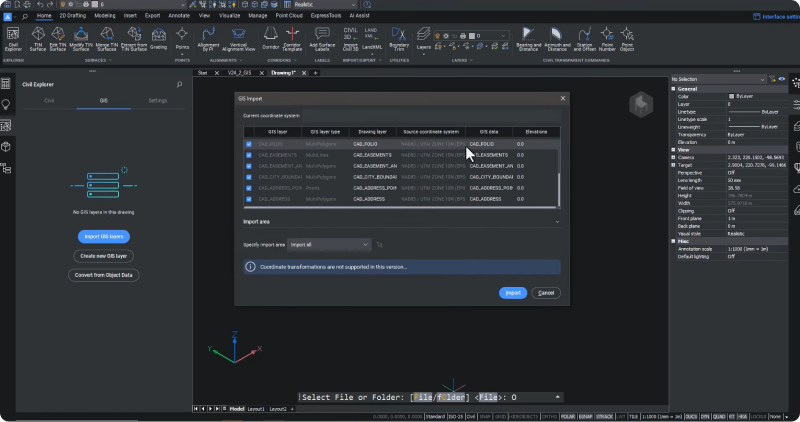
In an exciting development for GIS data management, BricsCAD® V24.2 now offers support for importing GIS data directly from file-based geodatabases. Now, users can manage multiple data layers within a single GDB file, effectively bypassing the 2 GB file size limit that restricts shape file attribute tables. This opens up new possibilities for handling complex spatial data and significantly streamlines the data management process.
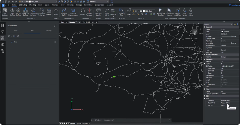
We also streamlined the import process for shape files, so now you can directly select a folder, and BricsCAD will show you which files you have already loaded within your drawing.
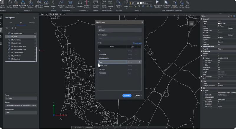
BricsCAD® V24.2 takes GIS data manipulation a step further by enabling users to edit the format of fields of existing GIS layers, improving data clarity and usability. We also introduced clip polygons for targeted data import, and the enhanced accessibility of GIS attribute data in the properties panel makes data management more efficient and user-friendly.
New Workflows and User Experience for TIN Surfaces and Points
The V24.2 update introduces enhancements specifically designed to speed up your workflows and improve your overall user experience! Civil and survey users will feel the difference when handling TIN surfaces and point groups. The revamped user interface features intuitive dialog boxes to make point group management and TIN surface editing more efficient than ever. These dialog boxes simplify the creation and management of point groups, allowing for easy addition of descriptions, selection of points, and use of a filter box for efficient organization.
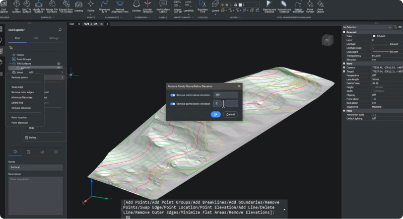
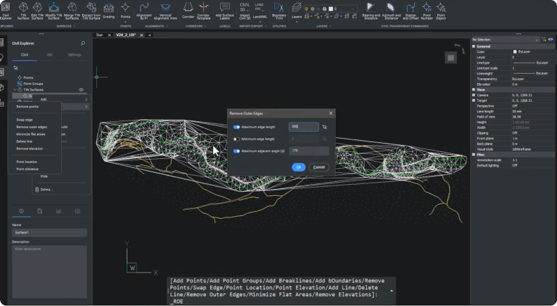
We’ve equipped BricsCAD V24.2 users with new dialogs for working with TIN surfaces. These provide editing capabilities to help with tasks like elevation adjustment, outer edge management, brake line addition, and targeted point removal within a TIN surface. These enhancements aim to reduce errors and remove rework, bringing intuitive tools that will accelerate your time to deliverable!
BricsCAD® V24.2 delivers better tools for civil engineers and surveyors, designed to optimize GIS data management and TIN Surface workflows. With its advanced support for importing GIS data from geodatabases, improved data manipulation tools, and a user-friendly interface for managing TIN Surfaces and Points, BricsCAD® V24.2 will enhance your workflows and ensure that data is more accurate, comprehensive, and user-friendly!


 Tiếng Việt